by Cyclist Yoni, rides Brompton, Gravel and MTB
When we started Cyclondon, the vision was to have a fun cycling blog. Our secondary aim is to help newbie cyclists getting comfortable with cycling and to write posts which veteran cyclists can enjoy too. While Coronavirus forced a cycle-frenzy in the UK, we decided this blog would be aimed not just at Londoners (despite its name), and not only for sharing and suggesting routes. We believe that posting cycling gear reviews, is equally important. Currently, the writing staff is still thin, nor do we have major cycling brands standing in line. However, if there is one question that comes up a lot in the various Facebook cycling groups, especially by new cyclists, it's "What cycling app to use?". We will try to help you with this cycling apps review.
"What cycling app to use? or rather cycling navigation app is a great question, and especially important for new cyclists who are still trying to work their way around the best cycling routes, in terms of quality, safety, elevation and generally finding the quickest route to get to their destination. In London, this is especially complex, as many Londoners are not native to the city, and even the natives tend to get confused, stuck between roadwork and dead-end streets, and quite frankly do not know most areas of this vast metropolis.
A word of wisdom - take this review with a grain of salt. While I will fully disclose the apps that I've been using and the ones that were recommended to me by others, still, this remains very individual. Someone might like one app over the other, or someone might choose a specific functionality over interface etc. In other words: while I do have a bit of cycling experience, this review is extremely subjective.
Another note: I've been careful to choose apps that cover the aspect of city navigation. While other functionalities are important, niche apps which specialize in fitness, elevation cycling or cycle hire were excluded.
The most professional: Strava
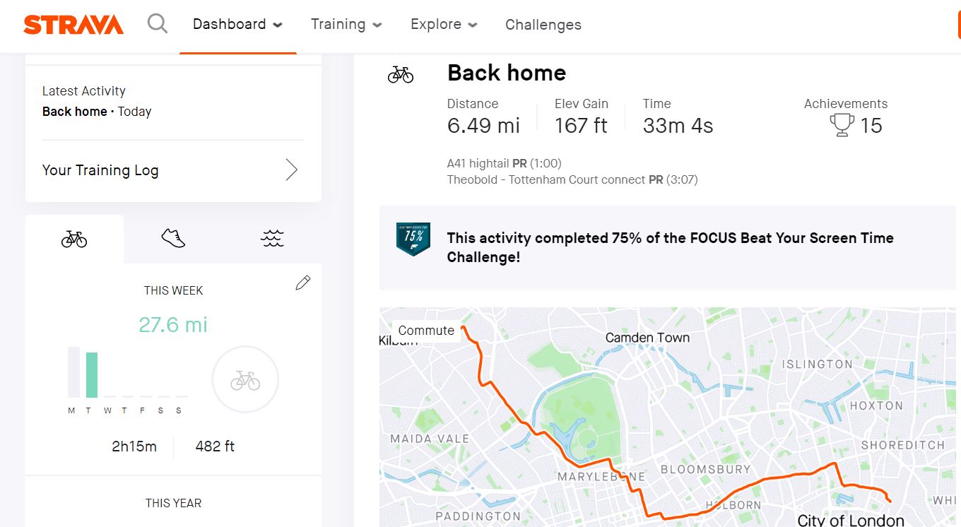
Strava is by far the most professional app around both for cycling and for running. It allows GPS live route tracking and following a pre-designed track. It will auto pause when you are stationary, which means you can actually see how long it takes you to cycle a specific route, even if you stopped for a cuppa along the way.
Also, Strava is effectively a social network: you can follow other cyclists and give them "Kudos" for rides they've done; you can tag pictures in your rides; mark other users you've been cycling with; and even compete with other users.
Like most of the Apps it comes with both a free or a paid premium subscription. The latter adds functionality which had been annoyingly scrubbed off the free version, such as: creating maps, connecting to various heart tracking monitors. A nifty feature is the lifetime heat-map : it will show you your most used roads, and is very cool.
🔗 Connectivity: While Strava has good connectivity with Garmin and Fitbit, and would allow Beehive and some other apps to connect to it, it does lack connectivity with other HR apps such as MYZONE.
👑 Only premium: Building your own route maps used to be an inherent ability of the app, which nowadays works only for premium users. That's a bit annoying when you get used to an app and can no longer plot your route on it beforehand.
😎 Cool feature: "king of the segment" - the app allows you to see how well you are positioned in certain segments, and create new competitive segments. If you'd reach a segment someone had created, you will see live how you match up ; Auto pause when stationary.
💯 Best for: Socializing.
👎Lacks: Speedometer.
The most attainable: Google Maps
 Everybody knows Google Maps, so there is no real need to elaborate about this Google based app, which pretty much everybody already use. What most people don't know is that Google Maps has an underlying cycling layer which marks cycling dedicated roads in green, and cycling lanes in a dashed green line.
You can ask the app to plot a cycling path between two coordinates, and mark it as "cycling". However, based on talks I conducted with other app providers who uses Google Maps as an underlying layer, we can confirm that it does not seem the app is taking any elements other than cycling roads into consideration, and that some of the plotted routes are generally considered "bad".
🔗 Connectivity: none. 👑 Only premium: no premium version.
😎 Cool feature: change the terrain to Google Earth satellite image.
💯 Best for: Free updated routes.
👎Lacks: cycling supporting features; connectivity.
The new kid on the Block: Beeline
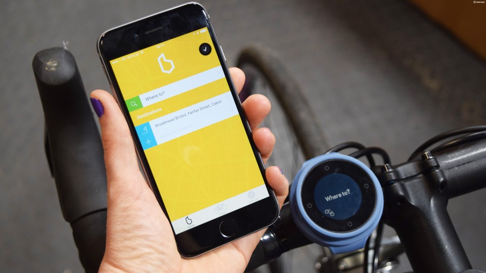
 Beeline is a relatively new app, and yours truly had helped with its beta stages (as a tester, I have no affiliation with the company). The Beeline combines both an app and a navigation unit that connects to the bike handlebars or stem. That way, if you don't have a mount for the phone, or prefer to keep it in your bag/pocket, you still get directions from a compass-like arrow on the Beeline unit, which communicates with the app via Bluetooth.
You can set points along the plotted routes so that the Beeline will be forced to direct you via them. An example: you use the app to plot a route between two places, and the unit will show you which way to go, by using the arrow and a mile indicator much like a GPS device (i.e. 'turn left in 0.5 miles'). There's an ability to shift between the compass mode, general millage done/left, clock and your current speed of travel. There's no need for a mount, the device comes with a silicon mount/strap which is also a case, that attaches to any bike.
🔗 Connectivity: The app connects well with Strava and you can use Strava's routes for your Beeline. You can also upload the routes you've traveled to Strava, so effectively you don't need both apps open.
👑 Only premium: Given the fact that you need new hardware (the Beeline unit), there's no free version, and it costs £99.
😎 Cool feature: The device itself is cool and innovative, the fact that you don't need the phone is a bonus; the speedometer.
💯 Best for: Urban cycling.
👎Lacks: The company wishes to be "Waze for cyclists" and it lacks a bulk of users to get a good sense of all roads. This is likely to fix itself when usage grows.
The most recommended over the web: Citymapper
Citymapper's aim (according to the company) is "Making Cities Usable". The app uses the power of open data, mobile and payment technology to make transport sustainable and hassle free. It covers 41 major cities in the world. However, the app is designed to work with public transport in general (including cycle-hire) and is not meant solely to be a cycling app.
Imagine a more user-friendly TFL journey planner if you may. It appears that the company is more focused on it's combined Pass-card for travel and less on offering a real solution for cycling. I have come across this as many users recommend the app on various Facebook groups, however I came to realize that there are better options for urban navigation.
Bikemap
 Founded in 2014, Bikemap cycling app was created by passionate cyclists. They boast about more than 3.2 M users worldwide, and over 5.4 M unique cycling routes in 100+ countries. In short, it's a GPS for cycling, with voice navigation, which can be great when conditions make it hard to check your phone, or irksome when you want to enjoy a quiet ride.
While it is generally an app meant for cycling navigation (and does what it says on the box), it strikes me as an app which will benefit cyclists along new paths and places, and not necessarily the best option for your day-to-day urban navigation. It's hard to understand from the app the standards under which it plots routes, rather it seems that you are the one meant to prepare the route beforehand.
🔗 Connectivity: The app connects with Garmin, and generally can use routes from every devices that can export GPX and KML map files.
👑 Only premium: Change map styles, route optimization, use offline.
💯 Best for: Outdoors and adventure bikes.
👎Lacks: The core features of route optimization (which is what we're after here) are not available for free users.
Komoot
 Much like Bikemap, Kommot cycling app is a user fed system, which allows cyclists to log rides that will be used later to help riders plan their own future rides. There are over 10 million users worldwide, and yet they seem more humble about this than their direct competitor.
The app shows which routes are suitable for road, gravel, MTB, classifies them by level of rider-fitness and allows to plot a route based on these parameters. It uses users recommendations and images, to supply extra information along these routes.
When I tried using the route plotter for a simply urban 7 mile ride between my house and work in the City of London, I got several different results. I remain unsure why Regent's Park for example is the best for gravel cycle, while for road cycle, the app sends me via the congested West End .
🔗 Connectivity: The app connects with a full range of Garmin products, but none of the other HR monitors.
👑 Only premium: Voice navigation, offline maps, free map updates and tour export for your GPS device.
😎 Cool feature: The device supports hikes and mountaineering!
💯 Best for: Outdoor adventures and MTB.
👎Lacks: route plotting by elevation/road safety.
The bottom line is that Komoot looks like a very good app, with a wide user base, that is more suiting for bike touring or MTB, even though some users have recommended it as their app for urban routes.
Endmondo
 The main issue with Endmondo, a cycling app by Under Armour, is that it's a bit mixed up. Is it a route plotter, a coach or a social media? Well, it's a bit of everything. Much like Strava, which seems like its main competitor, it is aimed at cycling and running.
Much like Strava, there is GPS tracking and a summary that includes a map. Data such as duration, distance, and heart rate if you wear a compatible heart rate monitor. The other main issue is that most of its good features come only with premium, and if you compare its free plan with the Strava free, Endmondo doesn't live up to the challenge.
🔗 Connectivity: A wide variety of heart monitors, among others Garmin, Fitbit and Polar.
👑 Only premium: Detailed training plan and heart rate data, such as a graph showing how much time you spent in different heart-rate zones, offline maps, free map updates and tour export for GPS devices.
😎 Cool feature: Auto pause when stationary. Vocal encouragements (if you're into that sort of things).
💯 Best for: Personal trainer.
👎Lacks: Route plotting by elevation or road safety.
Worth a shout: Cycle Streets
 CycleStreets is a web-based cycling app which can be accessed on cyclestreets.net. It's a UK based map database, or as they put it: "A UK-wide cycle journey planner system, which lets you plan routes from A to B by bike". It is designed by cyclists, for cyclists, and caters for the needs of both confident and less confident cyclists.
You can plot a route and choose its feature: quick, quiet, avoid ascents, etc. It's not an app per se, but it's simple, clever and free. It's still in Beta mode.
If you don't have one of the fancy apps, I suggest giving this a go to look at routes vs. Google maps. You can also export the plotted routes to a GPS device or to view it on Google Earth. Very nifty!!
Good to know: Fill that hole
Okay so not a cycling app per se as well, but a wonderful initiative from UK Cycling, to help fight the dreadful conditions of the UK roads. On Fill That Hole app You simply report a pothole you come across on your route, and the people of UK Cycling will report it to the appropriate local council.
If you can add a photo and details, the better. The app reports 40k potholes mended (out of 177K reported), a 23% success rate, with an average of 36.1 daily reports.
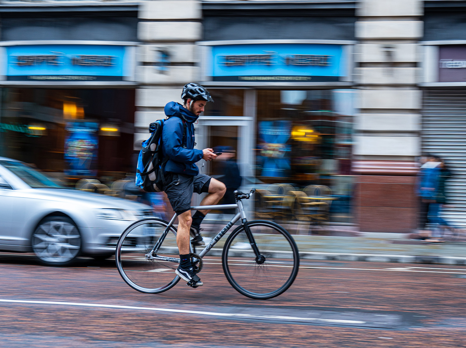
In conclusion, I have demonstrated a few good options for navigation apps available out there, that can benefit both urban cycling and adventure seeking. There may be apps which I have overlooked, and if I did, I do apologise, and would love it if you shared them in the comments section on this page. Also, if you know a feature of the above apps which I missed, please let me know.
The bottom line is that navigation apps are individual. The only suggestion I can make is giving some of the above's free versions a go, and to upgrade to premium only when and if you decide this is the way to go. If not, there are enough free alternatives out there currently, and if you're "lost" you can always give us ashout on our Facebook page. Happy navigating!

